Mahia Peninsula - photos
 |  |  |  |
 |  |  |  |
Related Photo Galleries | |||
 |  |  |  |
About Mahia Peninsula
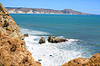
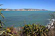
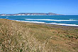
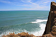
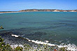
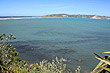
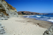
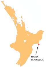 Mahia Peninsula lies in Hawke's Bay between the cities of Napier and Gisborne.
Extending 21.7 km1 (3.5 miles) long and 11.3 km (7 miles) wide it rises as high as 397 metres (1,302 feet) above sea level. Once an island, a sand bar connected it to the rest of the North Island.
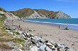
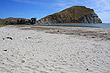
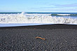
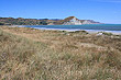
Mahia is known for its surf and fishing and makes a good day trip from Napier, Hastings, or Wairoa. There are also a number of nice walks here with photo opportunites.
 Mahia Peninsula is also home to Rocket Lab a commercial spaceport located near Ahuriri Point. It was the first private spaceport to successfully launch a rocket into orbit.
Author & photographer: David Johnson (Virtual New Zealand). Providing a credit or link is appreciated.
Our content: logos, site names, text, photos, and website design are protected by international copyright law.
Original versions of our photos can be purchased / licensed & web versions can be shared subject to conditions.