Mangawhero River - photos
 |  |  |  |
 |  |  |  |
 |  |  |  |
 |  |  |  |
Related Photo Galleries | |||
 |  |  |  |
About Mangawhero River
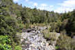
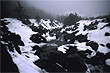
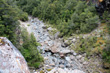
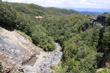
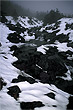
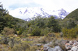
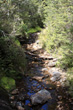
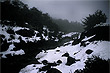
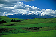
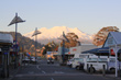
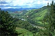
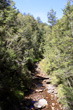
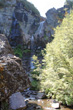
Mangawhero River flows from the snowy slopes of Mt Ruapehu within Tongariro National Park and continues through the lower forested slopes of that volcano and passed the ski resort township of Ohakune. From there, it winds across rural landscapes and enters a gorge. The river eventually discharges into the Whangaehu River in the Rangitikei District of Manawatu-Wanganui.
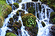
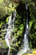
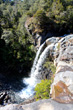
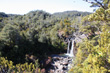
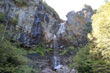
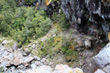
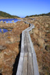
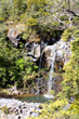
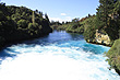
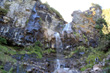
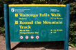
Although not a significant national river, it is seen by drivers who drive up the slope of Mt Ruapehu and offers some scenic spots along that road. It also has a number of notable waterfalls and cascades as it descends Mount Ruapehu. A number of scenic forest walks offer access to these waterfalls such as Waitonga Falls Walk and Mangawhero Walk. The lower reaches of the river is best for fishing and there is also the scenic Raukawa Waterfall at Kakatahi.
More Photos | |||
 |  |  |  |
Author & photographer: David Johnson (Virtual New Zealand). Providing a credit or link is appreciated.
Our content: logos, site names, text, photos, and website design are protected by international copyright law.
Original versions of our photos can be purchased / licensed & web versions can be shared subject to conditions.