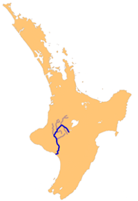
Whanganui River - photos
About Whanganui River
 The Whanganui is the third longest river and longest navigatable river in the country. Through its 290 km long (180 miles) course, it flows through pristine rainforested hills, Whanganui National Park, lush farmland, and some small settlements with names like Pipiriki and Jerusalem.
There is a turn of the century paddle steamer operating tours, but a road also follows part of this river.
Author & photographer: David Johnson (Virtual New Zealand). Providing a credit or link is appreciated.
Our content: logos, site names, text, photos, and website design are protected by international copyright law.
Original versions of our photos can be purchased / licensed & web versions can be shared subject to conditions.


