Rimutaka Range - photos
 |  |  |  |
 |  |  |  |
 |  |  |  |
 |  |  |  |
 |
 |
 |
 |
Related Photo Galleries | |||
 |
 |
 |
 |
About Rimutaka Range
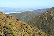
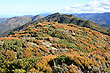
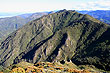
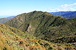
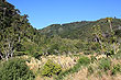
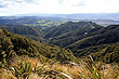
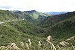
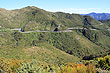
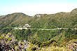
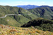
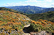
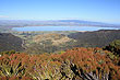
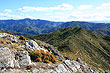
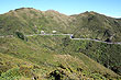
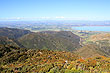
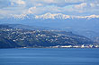
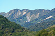
The Rimutaka Range is part of a North Island mountain chain that runs from the Gisborne region down to Wellington region. The Rimutakas identify the southern end of these mountains and divides Wellington from the nearby region of the Wairarapa.
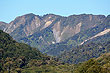
This range extends from Turakirae Head a promontory on the southern coast of the North Island, to the end of the Hutt Valley marked by a the Rimutfsaka Hill Road. Beyond that boundary is the southern part of the Tararua range.
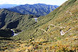
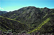
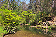
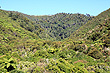
The climate to the west of these mountains is wetter which creates a lush landscape. To the east a drier warmer climate helps support a burgeoning wine industry. Within the range itself, there lies lush temperate beech and rainforest as well as alpine vegetation higher up. There are many great bush trails that pass through differing and rich flora accompanied by rivers such as the Wainuiomata River.
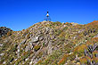
The Rimutaka Range is little known by tourists, but locals see it as a place to go bush which means to get away from it all. Hunting is permissible in the bush, excluding the portion within the Rimutaka Forest Park.
The hills get their name from Haunui-a-Nanaia, who it was said sat down and took in the view - 'remu' means 'to gaze' and 'taka' means 'to sit down'. These mountains are now known by the correct spelling 'Remutaka'.
Looking for more photos of the Rimutaka Range?
Author & photographer: David Johnson (Virtual New Zealand). Providing a credit or link is appreciated.
Our content: logos, site names, text, photos, and website design are protected by international copyright law.
Original versions of our photos can be purchased / licensed & web versions can be shared subject to conditions.