Hutt River - photos
 |  |  |  |
 |  |  |  |
 |  |  |  |
 |  |  |  |
Related Photo Galleries | |||
 |  |  |  |
About Hutt River
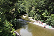
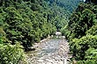
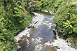
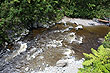
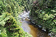
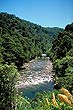
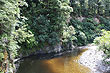
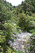
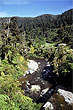
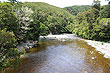
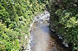
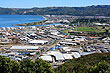
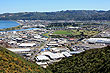
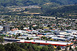
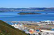
The Hutt River flows from the Tararua Ranges to Wellington Harbour in southern coast of the North Island. On its 56 km journey, it has formed a fertile narrow plain that extends from the upper reaches of the Hutt Valley to the northern coast of Wellington Harbour.
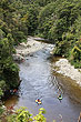
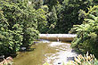
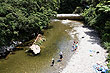
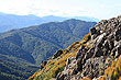
Kaitoke Regional Park in Upper Hutt contains a protected area of the Hutt River where clean fresh water is used as drinking water for much of the Wellington Region. Kaitoke Gorge below this protected area is a popular area for kayaking, rafting, swimming. Further down again, the Akatarawa River joins the Hutt from the west and then flows through populated areas in the Hutt Valley including, central Upper Hutt, and Lower Hutt, Petone, into empties into Wellington Harbour. The Hutt River has stopbanks in this populated area as well as willow trees to stop the effects of flooding which is common in Winter.
360° View of Hutt River Gorge
Author & photographer: David Johnson (Virtual New Zealand). Providing a credit or link is appreciated.
Our content: logos, site names, text, photos, and website design are protected by international copyright law.
Original versions of our photos can be purchased / licensed & web versions can be shared subject to conditions.