The Australian Continent
The Australian continent is one of Earth's main continents. It encompasses the Australian mainland, the island state of Tasmania to the south, and the island of New Guinea to the north.
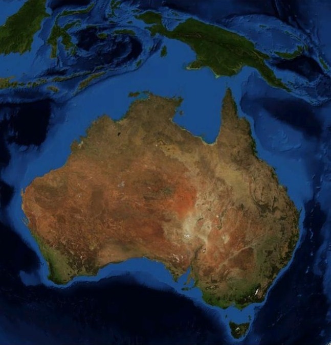
The light blue colour shows the approximate shape of the Australian continent.
Earth's Continents
By most accounts, Earth's continents include: Europe, Asia, Africa, North America, South America, Antarctica, and Australia. Europe and Asia are technically the same landmass called Eurasia, but most models separate them.
The nation of Australia is not to be confused by the continent of Australia which includes other countries. Additionally, New Zealand is not part of the Australian continent as many expect. New Zealand actually sits in its own geological continent called Zealandia. This mostly submerged continent doesn't connect with Australia. Its closest point is a mere 25 km to the east.
Australian Continent
Unlike Zealandia, the Australian continent is mostly above today's sea level. It is comprised of three main contiguous landmasses. They are New Guinea, the Australian mainland, and the island state of Tasmania. The most northerly point of the continent is the northern portion of New Guinea in the tropics. This island is separated from the Australian mainland by the shallow seas of Torres Strait and Arafura Sea. Tasmania to the south of the Australian mainland is separated by the shallow Bass Strait.
Climatic Zones & Landscapes
The Australian continent has a total land area of 8.56 million square kilometres (3,310,000 sq mi). New Guinea to Tasmania spans many climatic zones from tropical or equatorial in the north to temperate in the south.
The landscapes are varied. High mountains and tropical rainforests exist in New Guinea. Smaller mountain ranges, deserts, grasslands, and tropical to temperate rainforest exist in mainland Australia. Tasmania to the south is a mountainous island with large areas of temperate rainforest. The continent sits mostly in the centre of the Indo-Australian Plate so it has no active volcanic regions unlike all other geological continents.
History
Once part of the greater continent of Gondwana, the Australian continent broke away about 96 million years ago. For most of its journey, Australia, New Guinea, and Tasmania have been a continuous landmass. Only in the last 10,000 years have the sea levels risen high enough to separate Tasmania and New Guinea.
Further Afield
Other areas in the Australian continent include: Seram Island the largest island of Indonesia and the island of Timor. Both Seram and Timor have experienced the most uplift due to being located above the subduction of the Pacific Plate under the Australian plate. While New Guinea is the most northerly part of the continent, and the most tropical, the altitude of the highlands of New Guinea have a cooling effect. Many animals and plants that were once common across the Australian mainland now survive only here due to the warming up of the Australian mainland as it journeyed north into a more arid zone.
Australia, country or continent
Author & photographer: David Johnson (Virtual Australia). Providing a credit or link is appreciated.
Our content: logos, site names, text, photos, and website design are protected by international copyright law.
Original versions of our photos can be purchased / licensed & web versions can be shared subject to conditions.