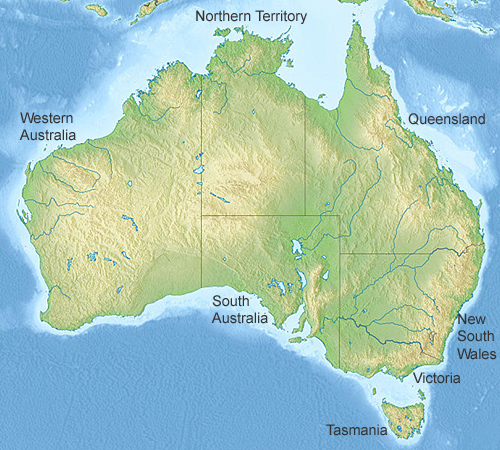
Australia Relief Map

Click on the map to see the main cities of Australia.
The most mountainous or hilly state in Australia is Tasmania, followed by Victoria, New South Wales, Queensland, Western Australia, Northern Territory, and South Australia as the flattest state. The biggest range is the Great Dividing Range which is also the fifth longest mountain range in the world. Rivers that run westward from the Great Dividing Range in Victoria, New South Wales, and the southern third of Queensland flow into the Murray–Darling basin which is the most significant agricultural area in the country
The Australian continent is situated below Asia. It is bordered by the Pacific Ocean in the east, the Indian Ocean to the west, the Southern Ocean and the Tasman Sea to the south, and the Timor Sea and Arafura seas to the north, and the Coral Sea to the north/east. The nearest country is not New Zealand as many think, but Papua New Guinea to the north. Cape York on the Australian continent is 150km away from Papua New Guinea although the Torres Strait Islands are further north and belong to Australia. There are at least 274 small islands in this group, but most are uninhabited.
Author & photographer: David Johnson (Virtual Australia). Providing a credit or link is appreciated.
Our content: logos, site names, text, photos, and website design are protected by international copyright law.
Original versions of our photos can be purchased / licensed & web versions can be shared subject to conditions.
