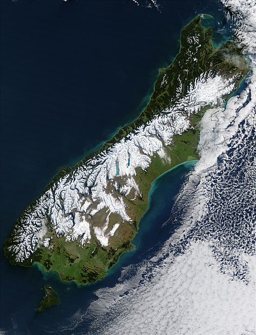
New Zealand Winter Satellite Image
Click on the map to see a satellite image taken in summer.
This cloud-free view taken in winter shows forests, mountains, tussock, farmland and winter snow. The nearest landmass is Australia which is about 2,000 km (1,250 miles) to the west.
Author & photographer: David Johnson (Virtual Oceania). Providing a credit or link is appreciated.
The website's, logo, name, content, photos, and design are protected by international copyright law.
Original versions of our photos can be purchased & web versions can be shared subject to conditions.