South Island Storm Satellite Image
Click on the map to see a view of New Zealand from the International Space Station.
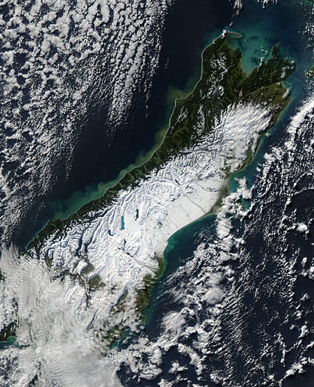
Satellite image taken on June 12, 2006. It shows the South Island after a huge winter storm swept across the country. Snow storms usually accompany a strong southerly wind originating from the Antarctica. The image shows clearly that the West Coast and top of the South Island are sheltered from this wind by the Southern Alps range.
Author & photographer: David Johnson (Virtual New Zealand). Providing a credit or link is appreciated.
Our content: logos, site names, text, photos, and website design are protected by international copyright law.
Original versions of our photos can be purchased / licensed & web versions can be shared subject to conditions.