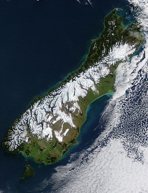
South Island Winter Satellite Image
Click on the map to see a satellite image taken in summer.
This almost cloud-free view of the South Island in winter shows extensive snow cover over the Southern Alps mountain range. It shows the near impenetrable barrier these mountains pose when travelling between the east and west coasts of the island.
Author & photographer: David Johnson (Virtual New Zealand). Providing a credit or link is appreciated.
Our content: logos, site names, text, photos, and website design are protected by international copyright law.
Original versions of our photos can be purchased / licensed & web versions can be shared subject to conditions.